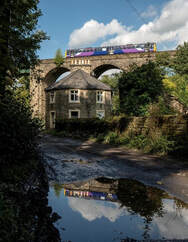
Friends of Marple Station
Find us on
  • Home
  • News
  • Campaigning
  • Walks
  • Join Us
  • Art & tigers
  • Agatha Christie
  • Links
  • Sunday trains
  • Photo competition
  • History
  • Data Protection and Constitution
We have a booklet of eight varied walks that start and finish at Marple Station. Many can also start or finish at other stations including Romiley, Broadbottom, and Strines. All are on rights of way and suitable for almost anyone. Marple can be gloriously muddy, and some of the paths are rough, so please dress appropriately. Things do change, so tell us at [email protected] if you spot errors or potential improvements.

Walks 6 and 7 originally used Morton Clough which is blocked due to a landslip.
Walk 6 section 2  should now read 'From the back of the visitor centre turn right onto George Street which bends left past the excellent Andrews Arms and left again into John Street. Walk up the lane past the ‘no vehicles’ sign and past School Lane Farm.
Just past Campville Farm, where the road bends left, you turn right down a narrow footpath, left over a stile and down and up stone steps turning left at another stile to reach Beacom Lane where you turn R
.'
 
Route 7 section 5 is now 'After going through a gate, a little further down you will arrive at a wooden bridge over a stream.  Cross over the bridge and follow the path over a stile up to the farm.  Keep the lower buildings on your left. Follow the track onto a road which leads down to Hyde Farm.   Pass the farm and follow the lane down into Compstall, passing the excellent Andrews Arms on the way. Turn right onto George Street to reach the visitor centre at Etherow Country Park.'

Thank you to everyone who helped put the walks together, including John Simpson, Jack Warner, Malcolm Booker and Jane Gallwey. Also to Marple District Rambling Club for checking the walks. The club organises an extensive walking programme for people of varying abilities. More details at www.marpleramblers.org or Claude Prime - 0161 483 8596​

Greater Manchester Ringway - a fabulous walk that passes Marple Station

​The GM Ringway  is an amazing 200 mile circular walk around the whole of GM split down into sections that are easily accessible by public transport including Marple and Strines stations.
The whole route is waymarked, has a great description and mapping on the website (no real need for your own map) and stage 'guardians' walk it regularly to look for any problems.
It was created by CPRE The Countryside Charity and the Ramblers to encourage access to our wonderful countryside.

Roman Lakes and the best of Marple 5.9 km (3.7m) Time 2 hours - easy

Picture
Click here for walk one
Picture

Walk 2 - Mill Brow, two great pubs and Brabyn’s Park - 8.5 km (5.3 miles) - 2.5 to 3 hours – moderate

Click here for walk two
Picture

Walk 3 - Mellor & Bottoms Hall - 8.7 k/5.4 m 2-3 hours – moderate 

Click here for walk three

Walk 6  Etherow Werneth Low & Mill Brow​

Picture
Click here for walk six

Powered by Create your own unique website with customizable templates.